The Colorado River
Grand Canyon National Park
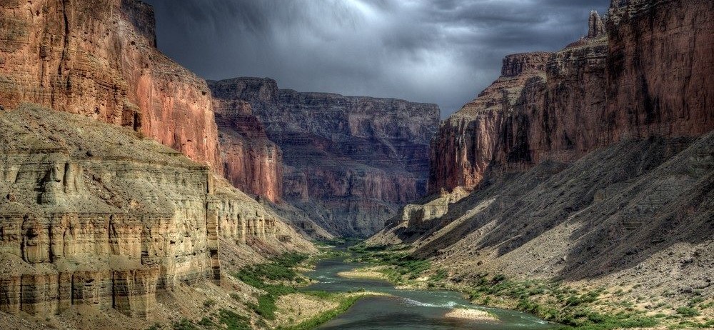
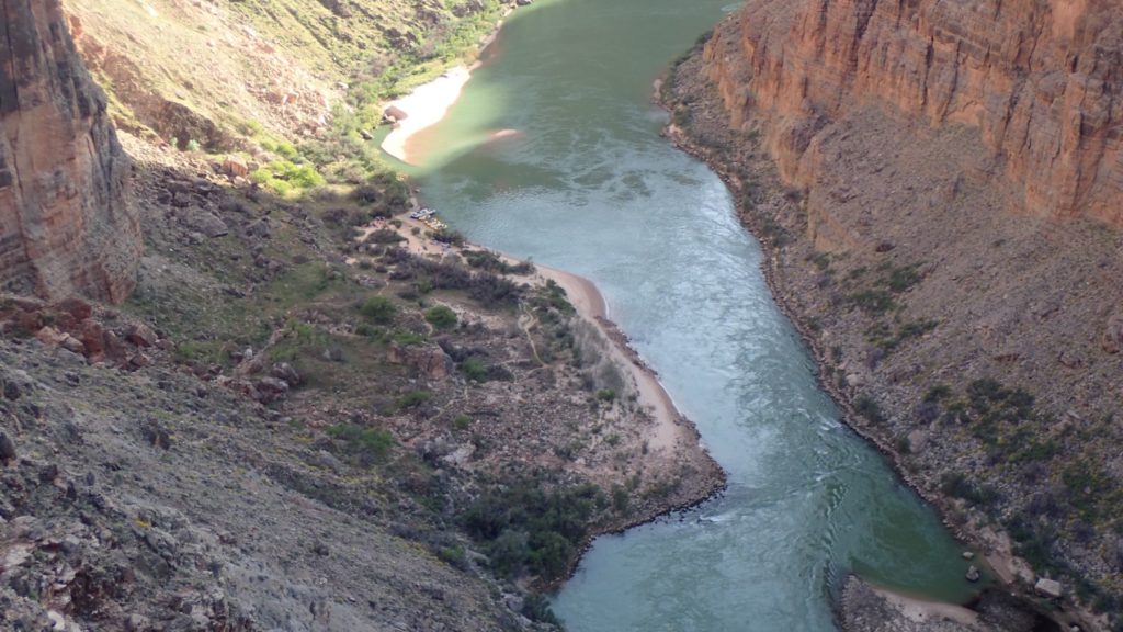
Often we hear the question, “What river runs through the Grand Canyon?” As part of its 1400 mile journey the Colorado River winds 277 miles through Grand Canyon National Park, revealing Northern Arizona’s breathtaking landscapes. Renowned for its world-class whitewater rafting expeditions, the park offers not only geological marvels but also holds the prestigious titles of a UNESCO World Heritage Site and one of the 7 Natural Wonders of the World.
Grand Canyon’s story goes beyond its rock formations and the turbulent Colorado River lying a mile below the rim. The Canyon provides habitat for a diversity of Flora and Fauna (plants and animals) unique to Grand Canyon. Remnants of pre-historic and modern humans remain within the 18 mile wide canyon.
Table of Contents
- Grand Canyon Geology
- Colorado River Cutting the Grand Canyon
- Rapid Formation
- Rafting the Grand Canyon
- Grand Canyon Flora and Fauna
- Human History
- Federal Protection
- Glen Canyon Dam + Video
Grand Canyon Formation – Geology and Geomorphology
The Grand Canyon is one of the greatest locations to visual North America’s creation. The bottom layers of the canyon started forming almost 2 billion years ago. The exposed rock layers tell the story of the environmental conditions and climate changes that created each layer as well as the down cutting to form the Grand Canyon.
Video: How the Colorado River formed the Grand Canyon
Rock Layers
The initial stages of the Grand Canyon’s formation started with the basement layer of igneous, Vishnu schist and Zoroaster granite. The softer, sedimentary layers of rock above the basement layer were deposited over millions of years. The sediment from advancing and receding seas, extinction events, arid desert environments and other environmental changes acted on by time and pressure created the distinct layers we see at the Grand Canyon today.
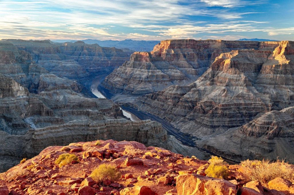
There are around 40 distinct rock layers within the Grand Canyon throughout its 277 miles. Additional layers were lost due to erosion. The Great Unconformity encompasses about 1 billion years of geological time unaccounted for, where erosion erased all evidence of the past. The Great Unconformity begins below the Tapeats Sandstone in the angled rock layers that form the Grand Canyon Supergroup. The Vishnu basement layer sits below the younger Paleozoic rock layers (Grand Canyon Supergroup).
Ancient Rock Groups
The three prominent rock groupings within the Grand Canyon are the Metamorphic basement rock group, the Precambrian Grand Canyon Supergroup, and the Paleozoic strata. The age of these layers’ ranges between 2 billion years (the Vishnu Basement Layer found at the bottom of the Canyon) and 270 million years (the Kaibab Limestone found on the Canyon’s rim). Rock layers inside the Grand Canyon contain three types of rock including igneous, sedimentary and metamorphic.
Deposited during the this time, the Vishnu Basement Layer formed around 2 billion years old. Volcanic eruptions formed floating landmasses that later cemented into place to form the basement layer of North America. Elves Chasm gneiss is the oldest metamorphic rock in the Basement Layer and dates back about 1.85 billion years.
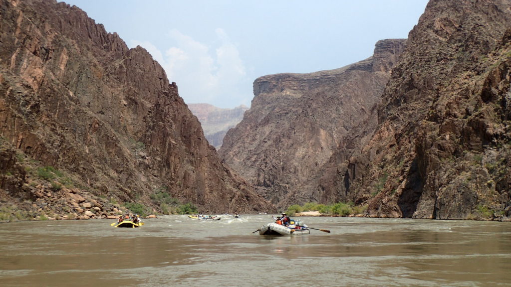
After the deposition of these first rocks an event called the Great Unconformity occurred eroding away the rock layers deposited directly above the Basement Layer. A time period of approximately one billion years is unaccounted for.
The Grand Canyon Super Group came next. It was formed from 1.25 billion years ago to 730 million years ago. Fossilized algae, the oldest remnants of life on earth can be found in these rock layers, however an abundance of life was not present in the fossil record, as multi-celled life had not yet evolved.
The Paleozoic Strata is comprised of sedimentary layers of rock in which multi-cellular fossils are common. Some of these layers of rock are made up of sandstone and have a reddish hue due to the fossilization of the colored soil that covered the continent during that time.
Video Explaining the Great Unconformity
Erupting Volcanos
Volcanic activity dating back between 100,000 and 3 million years flowed into the Colorado River at different sites and blocked the river’s flow creating natural dams. These dams were quickly eroded but signs can be seen at a number of locations within the river corridor. The rock deposited when volcanos erupted are the youngest in the Grand Canyon.
The Colorado Plateau Up-lift
The Colorado Plateau wasn’t always the high, flat plane that we know today. Around 70 million years ago the area that is comprised of the four corners region was uplifted during what is known as the Laramide Orogeny. The Laramide Orogeny took place during the Late Cretaceous Period , around 70-30 million years ago, and was the period of time when the dinosaurs were dying off, the continents were assuming their current locations on the globe and mountain ranges were forming. Scientists aren’t entirely sure why the plateau was lifted in such a way that each rock layer lie horizontally while other, similar physiological events caused rugged, craggy mountain ranges like the Rockies.
Colorado River Downcutting of Grand Canyon
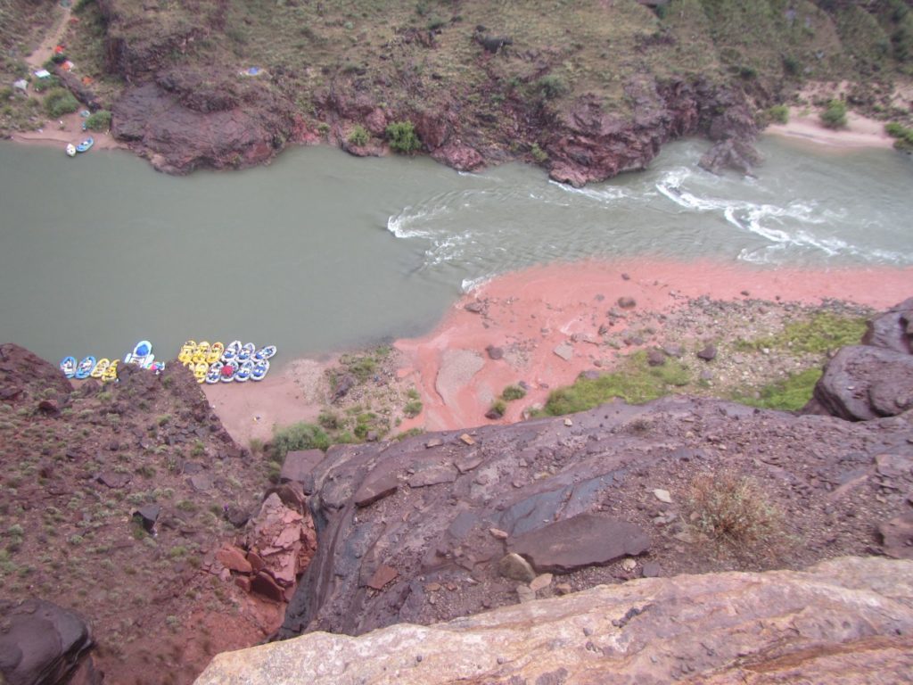
Most scientists believe the Colorado River and its tributaries began carving their path through the Colorado Plateau around six million years ago. The arid climate, large volume of water and steep gradient sped along the erosion processes that took place during the formation of the Grand Canyon. The fast flowing river quickly swept debris such as sand and rock downstream eroding the riverbed in a process known as down-cutting.
The soft sedimentary rock layers wear away relatively quickly worn away leaving a deep, steep-sided canyon rather than a valley. The Colorado and its tributaries continued down-cutting until the rock layers became more erosion resistant. These layers consist of the metamorphized basement layer of schists, gneiss, and granites. Down-cutting is still taking place but is happening at a much slower pace due to the hardness of the basement layer.
Rapid Formation
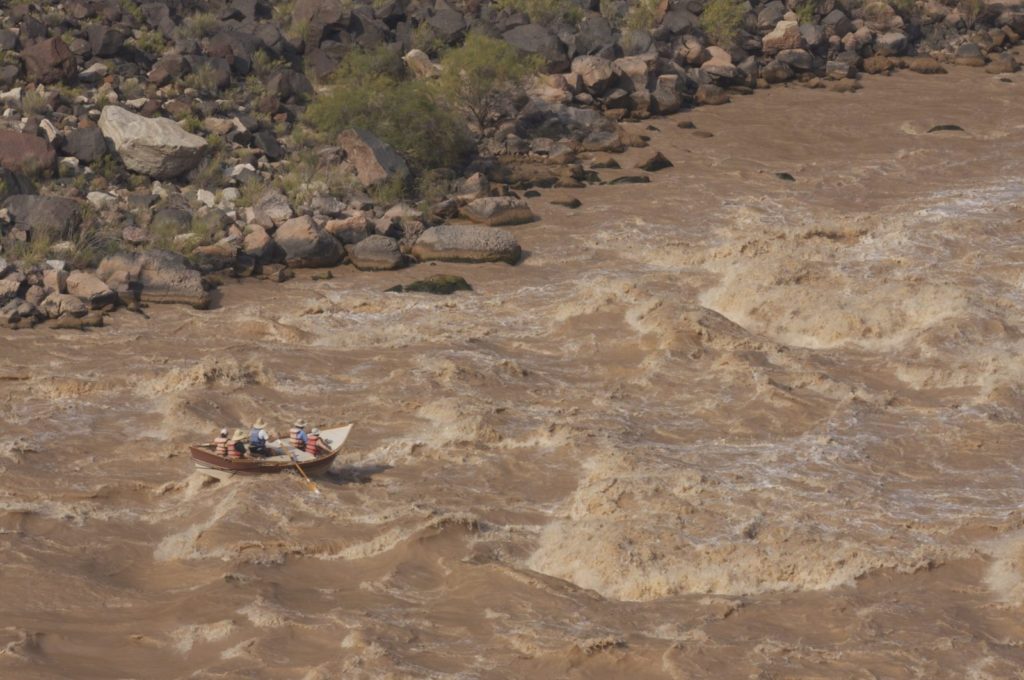
Rapids form when debris from side canyons is pushed out into the river causing the river to back up. As the river flows over the debris or if the debris constricts the channel, the river moves faster creating waves and other river features. In general more debris leads to more drop in the river and bigger rapids. The other main variable determining the difficulty of rapids is how high the river is flowing, more water usually means harder rapids. Read more about Grand Canyon rapids.
Rafting the Colorado River Grand Canyon
White water rafting through the Grand Canyon is in and of itself an experience to be sought out. However, the turbulent white water is merely the beginning. The river trip you embark on will offer plenty more that will interest you. An abundance of wildlife, unique vegetation, spectacular geology, and remnants of ancient civilizations will impress upon you just as much if not more than the thrill of running world class rapids.
Find Your Grand Canyon Rafting Adventure…

Find Your Trip
Request a trip search, we’ll find tours meeting your criteria.
*** Our service is free to you and paid for by our partner outfitters. We guarantee the same price as booking directly with the outfitter.
Early Colorado River Runners
Rafting in the Grand Canyon began in 1869 with John Wesley Powell, a civil war veteran, who during the war lost his right arm. He along with nine other men undertook the expedition to put the Grand Canyon, the last remaining unmapped space, on the map. Powell first traversed its length in 1869. He set out from Green River, Wyoming on May 24th and reached Lee’s Ferry (mile 0) two and half months later.
After losing most of the provisions, one of the four hefty oak boats and four of the men, the crew reached Grand Wash Cliffs (mile 277), the end of the Grand Canyon, on August 29th. Powell repeated the voyage again in 1872 and the U.S.G.S was finally able to completely map the US territory after surveying the rugged, previously impenetrable terrain that we know today as The Grand Canyon.
Commercial Whitewater Rafting
After the Powell expeditions there were other voyages through the Grand Canyon, but commercial whitewater rafting hadn’t taken hold there until 1938. Two botanists Dr. Elzada Clover and Lois Jotter wanted to document the Canyon’s flora. Norm Nevills, offered to take the ladies down in his wooden cataract boats for a fee. Nevill’s commercial rafting business took off when the trip experienced unusually high whitewater causing national press coverage. Dr. Elzada Clover and Lois Jotter were the first women to successfully raft the entire stretch of the Colorado River through the Grand Canyon.
Neville’s career ended when the small plane he was piloting crashed and killed both him and his wife Doris. He ran commercial trips down in the Canyon for a mere 10 years, but his efforts laid the groundwork for outfitting whitewater rafting trips through the Canyon. River runners previously employed by Nevills continued to run commercial trips after his death and initiated more river runners who sought to cash in on the growing number of white water adventure seekers.
Georgie White was the first woman ever to guide commercial rafting trips in the Grand Canyon. In 1952 she reinvented the wheel when she began utilizing inflatable rubber rafts. By lashing three rafts together and adding a 10 horsepower outboard motor to the back, surplus rubber rafts used during WWII ushered in a new era for river running through the Canyon.
The surplus rafts were easier to transport, store, and much more forgiving than the wooden drift boats and dories. She called her invention the triple rig, or G-rig and they were the inspiration for the modern motorized crafts popular in the river corridor today.
Grand Canyon Flora and Fauna
The Grand Canyon region contains diverse flora and fauna. Elevation changes from rim to river create environments similar to those found between Canada and Mexico. Of the seven biotic zones in North America, five are present here. The boreal forest is only found at the North Rim while the other 4 zones are seen hiking the Bright Angel trail.
5 Biotic Zones of Grand Canyon
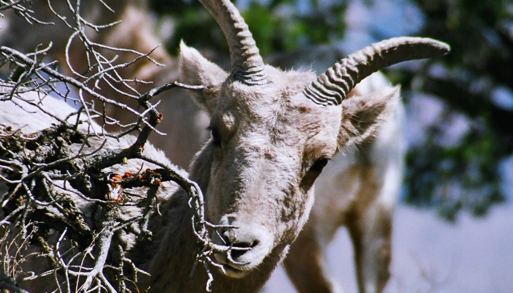
The boreal forest (Canadian), the Ponderosa Pine forest (Hudsonian), the pinyon-juniper woodland (transition), desert scrub (upper Sonoran), and desert (lower Sonoran) zones make up the five life zones found within the National Park. Variations in temperature and moisture combined with the canyon geomorphology allow for these ecosystems to exist. Animals within Grand Canyon include large undulates, rodents, birds, snakes, lizards, and countless insects. The canyon includes a variety of plants as well. See a breakdown of the flora and fauna of the 5 Biotic Zone in Grand Canyon.
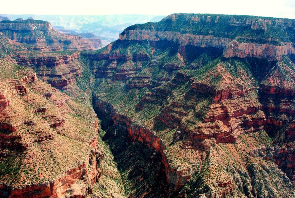
Native Fish
After the construction of Glen Canyon dam, several fish native to the Colorado River in the Grand Canyon have become endangered. Because of the dam, the water temperature declined and stopped being so muddy. This allowed non-native species like the cold water loving rainbow trout to thrive and compete for food and habitat. Fortunately, some tributaries like the Little Colorado River remain undammed providing a limited amount of habitat for native fish.
The dam, diurnally produces electricity for cities downstream does so by pushing water through its turbines. The varied water flows from the dam washes away insect larvae, an essential food source for fish like the chub.
Only a few native species survived. Endangered species include the bonytail chub, the roundtail chub, the humpback chub, and the Colorado pikeminnow which can actually grow up to 100 pounds despite its diminutive name. Other species include the razorback sucker, the bluehead sucker, the flannelmouth sucker, and the speckled dace.
Conservation efforts continue to improve endangered fish populations. Efforts have led to progress rebuilding the Humpback chub and other endangered species populations in their native environment. However, there remains a long battle.
Video: Humpback Chub Conservation Efforts
Recreational fishing is allowed on the Colorado River and its tributaries. Learn more about fishing in Grand Canyon National Park.
Grand Canyon’s Prehistoric People
About 10,000 years ago, at the end of the last ice age, people began to appear on the Colorado Plateau. Artifacts from this time include large spearheads, atlatls and other stone weapons. Early people used these weapons to kill large game such as the giant sloth and the wooly mammoth.
As the climate warmed these large, land dwelling mammals became extinct. Smaller game such as deer and bison still abundant required hunters to use smaller arrows. Arrowheads of this smaller size still exist throughout the Colorado Plateau’s landscape. Ancient Puebloan People refers to the nomadic hunter-gatherers who resided in the Four Corners region around 8,000 years ago. They are considered the ancestors of the modern Native American tribes associated with the Grand Canyon today.
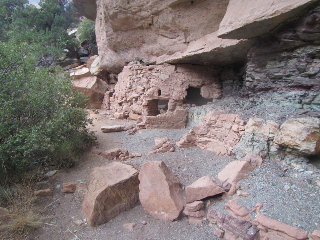
Ancient Puebloan People of Grand Canyon
Ancient Puebloan people were nomadic hunter-gatherers who occupied the Colorado Plateau 8,000 years ago. In addition to hunting and gathering, these indigenous people farmed with irrigation, weaved, and produced innovative pottery.
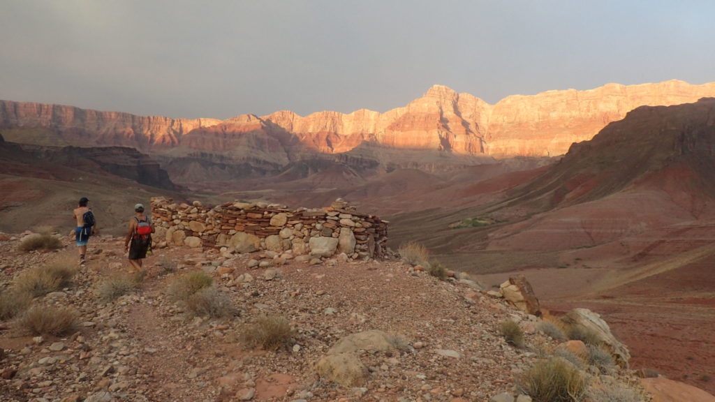
Summer along the Colorado river
Ancient people grew corn, beans, and squash inside the Grand Canyon. They took advantage of the natural terraces, abundant sunshine, the river and tributaries. However, once colder weather arrived, they migrated to the rim. Here they hunted game and gathered food to sustain the tribe throughout the winter. While it seems counter intuitive to spend winter at higher elevation, it was the best option. The Colorado River fluctuated more sporadically than in the summer and there is not enough sun to grow winter crops.
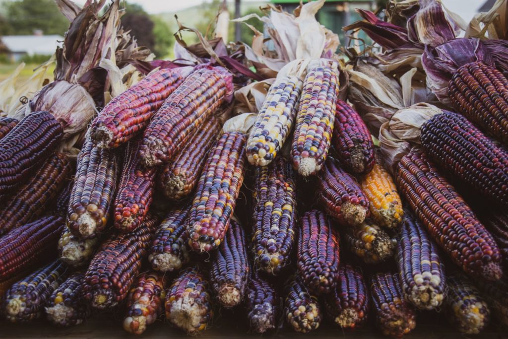
Evidence of this can be seen inside the dwellings found at the bottom of the Canyon. Inside the pit houses, a variety of items carried back from higher elevations were found including animal and plant remains. Archeological finds include pottery of various styles indicating trading was going on throughout the region and that multiple generations of families occupied the same pit house over thousands of years.
Over five hundred sites are known throughout the Grand Canyon. More than 10 modern tribes have oral histories with roots in the Grand Canyon. Ancient Puebloan people are said to be the ancestors of the Navajo, Hopi, Hualapai, Havasupai, Zuni, Paiute and more.
Split-twig animals resembling big horn sheep and deer are some of the most interesting artifacts found in the Canyon. The figures were made from a single twig which was split in half and carefully wrapped to resemble the mammals. They are thought to have been for the use of hunting ceremonies although they resemble a small toy. In 1933 the Civilian Conservation Corps began surveying and found figurines under rock cairns in caves throughout the Canyon. Figures date back about 4,000 years.
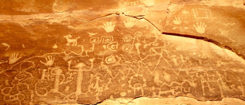
Petroglyphs and pictographs
Petroglyphs and pictographs remain throughout Grand Canyon and delight Grand Canyon visitors. Pictographs use pigments and still exist in protected locations, such as the inside of caves. Etched into the stone, petroglyph images survive on exposed cliff faces and similar locations due to their durability.
Modern Human History
Current Residents
The Hualapai, Havasupai and Navajo Tribes still have reservation land within the Grand Canyon. The Havasupai are the only year round inhabitants living along Havasu Creek within the canyon.
History of Federal Protection
On November 28, 1906, President Theodore Roosevelt established the Grand Canyon Game Preserve. While this led to a decrease in grazing, predator eradication continued. Using the Antiquities Act (signed in 1906), Roosevelt designated Grand Canyon a National Monument in 1908. Finally after 11 years of conflict, Grand Canyon became a National Park in 1919.
Glen Canyon Dam
Built from 1956 to 1966, Glen Canyon Dam totally altered the Colorado River through Grand Canyon. Prior to the dam the river was much more free flowing and would see high water in the spring and low water by late summer into the fall and winter.
Since construction, dam releases are at their highest in July and August to match peak power demands for the area. Historically, peak flows could get up to 120 to 130,000 cfs (cubic feet per second) depending upon the previous winter snowfall. These days the peak flows routinely seen are between 15 and 20,000 cfs.
Prior to the dam water was warmer. Today colder water comes out of the bottom of the reservoir. The river was also much more turbid transporting huge quantities of sand and silt that now fills Lake Powell. These changes have been hard on some native species within the canyon like the Humpback Chub. However, today there are many more species than there were pre-dam. Glen Canyon dam has also made rafting better with more reliable flows and cooler river temperatures.

